 By Vishal Gulati
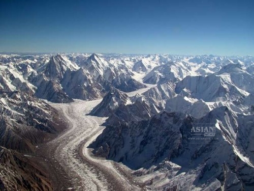
Glaciers in the upstream basin of the Brahmaputra, a 2,900-km-long river that originates from Tibet and flows into the Bay of Bengal, are likely to reduce alarmingly by the middle of the 21st century, according to an international body which also warned that the overall flow in the river was likely to increase.
“Hydrological modelling was carried out in the upstream areas of the Brahmaputra, which indicate the glaciers are likely to reduce by 20 to 55 percent by 2050,” Nand Kishor Agrawal, programme coordinator for the Kathmandu-based International Centre for Integrated Mountain Development (ICIMOD)said.
He said there were chances of increase in total water flow in the Brahmaputra.
“By 2050, the total runoff is likely to increase from zero to 13 percent due to fast melting of glaciers and increased precipitation,” said Agrawal, who travelled to Tibet to study impacts of climate change on the ecosystem and the communities.
About 60 percent of the inflow in the Brahmaputra is from rains. The remaining is from the glaciers, base flow and snow melt.
The feedback gathered by the ICIMOD from the pastoral communities settled in Tibetan plateau has indicated that the climate has changed a lot, resulting in uneven flow in the river.
“They say sometime the flow increases suddenly and sometime decreases drastically, which simply indicates the governments have to be prepared for the unexpected floods and draughts,” said Agrawal, who was in India for the workshop on climate change adaptation in the western Himalayas.
Studies conducted by the Tibetan administration in exile, which is based in this northern Indian hill town, say the Tibetan plateau is staring at ecological destruction.
“Human activities are mainly responsible for the destruction of Tibet’s ecological balance,” said in its report titled “A synthesis of recent science and Tibetan research on climate change”.
It said the temperature increase on the Tibetan plateau was twice the global average, resulting in quicker degradation of permafrost, drastic change on climate pattern and desertification of vast grassland.
To protect the Tibetan plateau from certain destruction, the report said there was a need for a water sharing treaty among the countries of the region and of making the Tibetan plateau an exploitation-free international observatory zone.
Climate researchers at the University of East Anglia and the Chinese Academy of Sciences in an online paper in US academic journal Proceedings of the National Academy of Sciences say the wettest individual year reconstructed in 3,500 years in northeastern Tibet is 2010.
They say precipitation during the past 50 years in the plateau has been historically high. They have reconstructed precipitation records by using sub-fossil, archaeological and living juniper tree samples from the plateau.
Tibetan spiritual leader and Nobel laureate the Dalai Lama has been saying his homeland Tibet is currently vulnerable to climate change.
“Many of the rivers which flow through large areas of Asia, through Pakistan, India, China, Vietnam, Laos and Cambodia, rivers such as the Yellow river, Brahmaputra, Yangtse, Salween and Mekong, all originate in Tibet.
“It’s at the places of origin of these rivers that large-scale deforestation and mining are taking place. The pollution of these rivers has a drastic effect on the downstream countries,” a post on his official website quoting the Dalai Lama said.
ICIMOD researcher Agrawal warned: “The current data indicates more flood risks in the future. If the Brahmaputra is not managed in Tibet, it will affect India and Bangladesh more.”
Currently, he said, the flooding in the river is not directly affecting the grasslands in Tibet, but may be this will never happen in the future.
“But its flooding can affect more in the downstream areas mainly in the floodplains of Assam,” he added.
The ICIMOD has been carrying out studies in Tibet and India’s Arunachal Pradesh and Assam districts under the Himalayan Climate Change Adaptation Programme in collaboration with scientists from China and India.